
Newfound Gap Overlook and trailhead to Charlie’s Bunion. It was a bit chilly up here!
Wow, so much has happened since our last blog post. We are still getting settled into our new home – as well as changing our domicile to South Carolina. I really want to write a post on what one has to do to become a resident of this great state – it’s not as easy as it was to become residents of Florida. I don’t want to forget and who knows, maybe one day some family members or friends will want to move here. It would be great to have the steps written down for them. But onto more exciting things!
When we got off the road, we knew we weren’t through traveling. Just like when we first bought our 5th Wheel on September 4, 2013, we didn’t know how our travels would work out. And now we can say the same thing about “settling” down – we know there is still so much to see in our great nation and so many things on our bucket list to see.
One such place was Smoky Mountains National Park (SMNP). We first visited the area in 2012. We stayed in a cabin in the Pigeon Forge area with our daughter, son-in-law and grand pup. Sadly, I didn’t write a blog post about the trip but I have pictures posted on my personal FaceBook page. We did a few of the same hikes, so I wanted to refresh my memory about them – but somehow, those pictures now seem to be lost in the outer spaces of the internet. Anyway, we knew this was a place we would return one day to do more hiking. We actually tried to get here several times in our motorhome but something always came up to hinder us….
This time, we stayed in downtown Gatlinburg – close to the entrance of the SMNP. After our time here, we’ve decided we’ll stay in this same location next time! While we don’t enjoy the traffic in either Pigeon Forge or Gatlinburg, heading straight into the SMNP from our location didn’t have any traffic….only once we got on either the Scenic Loop, were headed to a popular trailhead, or where the road was temporarily closed due to fallen trees. And we experienced all of these. Part of the traffic was the fact it was Spring Break for colleges all over the country – and we meet up with many students from all over the country! There is something about the caliber of the students who hike on Spring Break – they made us feel positive about the future of our country! I’m sad I didn’t get a picture of some of them, especially the five we met and enjoyed a lunch break from Perdue University!

Heading to the Smoky’s!
Our actual driving time from Myrtle Beach was six hours. Very doable – we knew we could get in a short hike upon arrival. Once we did arrive, Bill commented he was glad he was driving his car and not the motorhome! We stayed in a hotel rather than try to find a great deal in a cabin or condo – since our stay was only four days. Those deals are for at least a week. We had no idea we were blessed with a huge jacuzzi bathtub and a fire place in this hotel – an unadvertised feature! Off we went to the SMNP to get in a short hike. We stopped into the Sugarland Visitor Center to pick up a map to figure out the best hike to take. And then we met the Spring Break CROWD! The Visitor Center was packed as was the trailhead – which we had a bit of a problem finding….Miraculously, once we arrived at the rather large trailhead parking area, we scored a parking space as someone else pulled out!
Laurel Falls Trail – up up up! We actually had to ask a Ranger for a recommendation for the hike, about 2 1/2 miles in distance. At first, we rejected this one because she said it was paved and rated easy. But at 5 pm, we didn’t have any other option. So up we went – with a small crowd! As it turned out, with the elevation, it wasn’t really all that easy. We’ve been walking on the flat beach since October – ok, truth be known, Bill is in REMARKABLE shape and I struggled to keep up with him. Oh how the tables have turned since we first started hiking in 2003….

It doesn’t look crowded does it? We thought at 5 pm, we’d be alone….nope….They are all there, I just managed most of our pictures without the crowds.
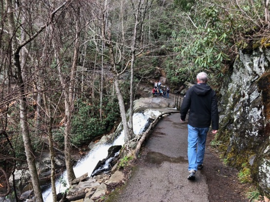
Almost there and now you can see a bit of the crowd at the falls.

The benefit of a crowd, we all helped each other take pictures! I had to try out the Bible Lens App to see what Scripture would pop up on this photo of the falls. Love it!

It was 5:45 pm when I took this of our descent back down. Lovely views!
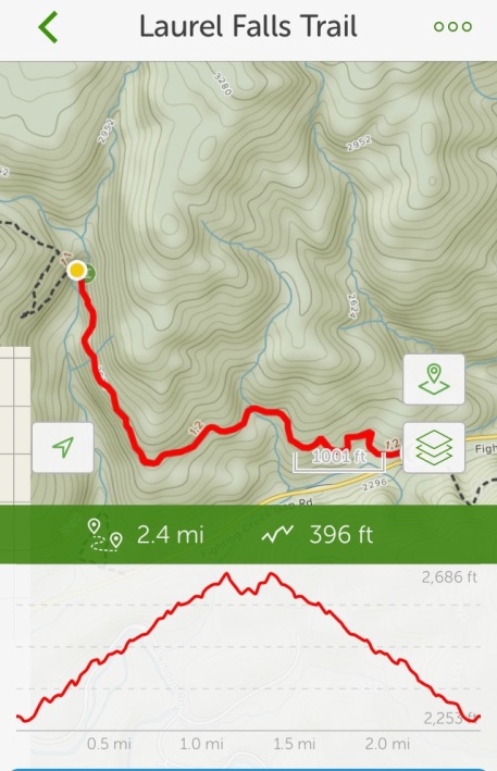
From All Trails App. While it was “only” 396′ elevation, it was in just over a mile, making it a bit steep. It was a great way to start our stay in the Smoky’s.
Charlies Bunion via Appalachian Trail – This hike was listed as “moderate” in one place and “hard” in another. Trust me, it’s a hard hike because of several places that are challenging. The way we felt afterwards, we said it was hard, but now as we reflect back, it was pretty moderate! Sadly, my watch (which tracks my steps and workouts) and iPhone batteries died around 7.3 miles in so I don’t have an accurate picture of our full hike. It was one the Ranger recommended with spectacular views. It was listed as 8.4 miles but we added at least 1/2 mile to it to go to a bluff that was more private. We decided on day 2, we wanted at least one long hike. The trailhead was at Newfound Gap (photo at top of blog post). We cropped out the crowds in that pictures – it was VERY busy as it’s also an overlook. But the best views were up up up the mountain.

Actual trailhead. There were restrooms nearby. The sign was confusing since it didn’t list Charlies Bunion but it had some markers on it for us (and others who were also headed there) to know we were on track.

Icy cold! And literally, there was ice, including black ice in portions.

One of our views on the way up.
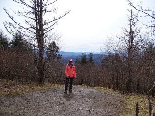
A popular outcrop. We meet several groups here. I took a few group photos for them but Bill was ready to go and didn’t want to let them take one of us! Maybe I was chatting a bit too much….
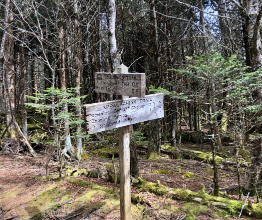
Here we see Icewater Springs Shelter is only .2 miles away and Charles Bunion is 1.3. Normally, we’d forge on, but we felt like a bit of a break was deserved! We’d gone 2.7 STEEP miles in almost two hours!

Icewater Spring Shelter. We enjoyed a light lunch break here with 5 students from Purdue University. They were engineer majors and were so pleasant to get to know – they really made us hopeful about the future of the USA!
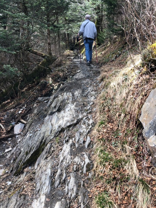
Someone left a book at the Shelter that described the next part of the trail: a razor edge trail. It was a razor’s edge all right! The students were up for it! And somehow, we did it, too!

The View from the Shelter. Makes me want to sing, “Oh How Majestic is Your Name” thanking our Creator!

The ice is melting and leaving a muddy and slippery trail in spots.
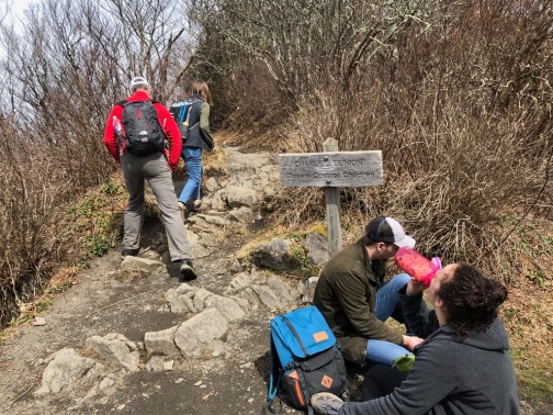
Time to turn up the hike to the top of Charlie’s Bunion. Or should we pass and go another .2 mile and who knows how high to the “real” top??? We decided to pass and forge on! Look like it might be a bit crowded up there?
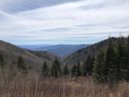
This is the view, we think towards the south. We are at the “shale” trail to head up to the “unofficial” top of Charlie’s Bunion.

I’m almost to the top of the shale trail. See the view in the background? That was the picture above this one. Going straight up! At points I almost felt like was should have been on all fours!

Remember, Bill is VERY uncomfortable with heights? This is him on the top of the mountain! We had this peak/cliff to ourselves! Nice!

Closer up of the peak!

My attempt at a panaromic view. Bill tried to take a video scanning the views but it didn’t turn out (whited out). We are supposed to be seeing Tennessee and North Carolina from here. We regret not saving one of the compasses for hikes like this.

I need a selfie stick!!!! Here we are, huddled on the peak!
Now to head back down! It took us three hours to get up here. This hike was supposed to be 8.6 miles according to All Trails App going via the Appalachian Trail. We went at least .2 miles beyond the peak and probably at least 1/10th up. So this calculates out that we at least went 9 miles not counting the side trail to the shelter and an attempt at heading up to Charlie’s Bunion the back way, picture below.
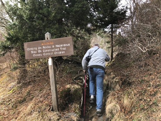
We felt great, so why not go on to the top of the other part of Charlie’s Bunion?
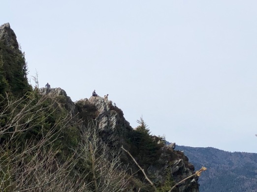
That’s the top of Charlie’s Bunion! We looked at it for a few minutes and saw several changes in people there – still crowded. There were two other couples in front of us asking it this was the way to the top. We said yes, but decided to not follow them. It was a VERY narrow path….

Here’s the official top of Charlie’s Bunion. I wanted this picture of me! This is the spot we passed up. Trust me, there was a crowd there and you have to take turns. Isn’t the view amazing, though? It was worth going the extra to have our own private spot – but Bill wouldn’t let me stand while he took a picture, so I found this blog site with more pictures. Click on the photo.

This was the last picture I took before my phone battery died. It was at 7.3 miles and at 4:00 pm. We started at 11:00 am and know we went over 9 miles. So we still had over a mile left. We guesstimate it was a five 1/2 hour hike for 9 miles. What a GREAT and memorable hike. I know my daughter now wants to do it, so I’ll get her picture up on top!!! 💖

From All Trails write up

This was all I managed to record before my phone died. I also had a mophi as my back up battery but it was too cold to work. I tried to warm it up but we were hustling back down the mountain and I had to hang onto my poles!
We wanted a really challenging hike and the Smoky Mountains delivered. So for our next day, we decided we’d take a milder hike and let our bodies rest a bit – or so we hoped. We are in the Smoky’s after all. But our overriding goal was to find more solitary hike. While we loved all the interactions and everyone (nearly) was polite, helpful and kind, it was a busy hike. After all, it is Spring Break and the SMNP is the most visited National Park in the country…..
Stay tuned to find out how it went! Our next two hikes are coming up.

Glad to see you still out exploring and hiking. Yeah, spring break can be a challenge with crowds. You’ll need to go back when it’s less crowded and get that scenic portrait.
LikeLiked by 1 person
We are so excited to be back on hiking trails!!! But we will admit, this trip has made us really miss our motorhome!
LikeLiked by 1 person
We have yet to make it to SMNP but it looks fantastic and like our kind of hiking (minus all the people). Love hikes through heavy forests and with lots of mountain views. Glad to see you all are still getting out there! Kind of the best of all worlds!
LikeLiked by 1 person
It’s worth a visit – but do lots of research! Clingman’s Dome is a must see (and climb to the top) but it was closed while we were there. I’m not sure why. But we did see it the first time we were here. Stay tuned for our next post – we found the hike less traveled!!! Only saw one hiker and had some great views! And while we did hike up to Charlie’s Bunion with a lot of others, the place we were told about just past it was totally private! No one else there, either!
LikeLiked by 1 person
I’m going to have to check this out! We’ll be passing through Tennessee and might have to make a detour to see the Smokey Mountains! 🙂
LikeLiked by 1 person
Oh they are beautiful but there are a few tips and tricks to take advantage of the beauty! I didn’t write about the visitor center. Talking with a Ranger helps you pick the hikes for your family. Lots of families had children that were miserable because they weren’t prepared. Poorly dressed, wrong shoes, out of water and out of shape! All the scenic hikes are up hill! You can drove to scenic outlooks but traffic can get backed up a bit. Timing is everything!
LikeLiked by 1 person
I love the Smoky Mountains! You found some beautiful – and looks like challenging – hikes! I hope you’ll get a chance to visit some of the national park while you are there.
LikeLiked by 1 person
We plan to get out of Myrtle Beach a few times a year for some great hiking! Our travels aren’t over-just a bit different. This trip has made us miss our motorhome for traveling though. But we’re adapting! 😉
LikeLiked by 1 person
Oh wow, very busy & exciting times! The adventure to the Smoky Mountains sounds fantastic, and you have such fab photos. Typical about dying batteries though. This is certainly one of those never-forget-it kind of trips, I’d love to go though I’m not sure how well my body would hold up with hiking! Where are you off to next? 😉
Caz xx
LikeLiked by 1 person
We’re in the State of Indiana this week. Then we’re heading back to our new home in Myrtle Beach, South Carolina. We hope to hit the road for some adventures every few months now. We’ve missed hiking! We’ve found this is something we both enjoy and it’s keeping us in shape. I’m sure there is something you’re able to do that helps you! Main thing is a positive attitude!!! ❤️
LikeLiked by 1 person