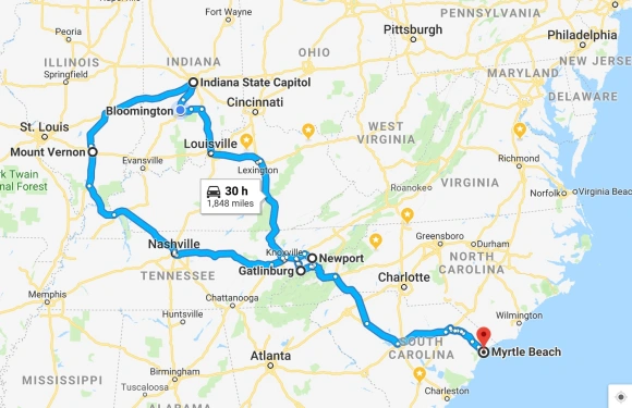
From our home in Myrtle Beach, to Gatlinburg, Tennessee; to Mount Vernon, Illinois; to Indianapolis, Indiana; to Bloomington, Indiana; to Newport, Tennessee; back to our home. 30 hours of driving time and 1.848 miles.
We’re on a two week road trip, which we didn’t spell out in our last blog post (click here if you missed it). We’ve been working hard on our new home (closed on it on 2/1/2019 in Myrtle Beach), getting it ready for our daughter, son-in-law and grandsons to spend their Easter Break with us. We needed a bit of a vacation break, but more importantly, we needed to spend time with Bill’s mom – to celebrate her 98th birthday and to be supportive of Bill’s brother and his wife. They have been her caregivers for the past five years. We are trying to cram as much as we can into two weeks while driving from Myrtle Beach through the Smoky Mountain National Park; to where his mom is in Mount Vernon, Illinois; to visit the State Capitol in Indianapolis, Indiana; to do some hiking near Bloomington, Indiana and then to spend one night in Newport, Tennessee to finish our drive back home.
We left you with a cliff hanger last blog post, so without further delay, let’s see how our third hike in the SMNP turned out!
The SMNP did not disappoint! You do have to do your research if you want to find your ideal hikes and there is no easy way on how to do it. We did stop in the Sugarland Visitor Center to ask for help for our hikes – but getting to the trailheads was another thing. We’ve also learned the value of reading reviews and they are pretty accurate on All Trails. I don’t recall if I found our next hike on-line here or on the app. I use both. Somehow I found the perfect hike, one that was less traveled. We only saw one other hiker, a back packer the three and 1/2 hours we were on the trail. Now that is solitude.
We had planned to come here this past fall. I found the Mount LeConte-it was a hike I wanted to do – very high elevation, challenging and great views. I forgot about it by the time we arrived here this time. There was no way we could do it after Charlie’s Bunion this week – so it’s on our bucket list and this is one we will do next time! But we may have been on a part of Mount LeConte – the mountains seem to run together.
Bull Head Trail – is noted for solitude. It goes to either Mount LeConte or to the Rainbow Falls. While we didn’t really want an aggressive trail, I failed to note the elevation on this trail! It turned out to be 1,421′ in 2 1/2 miles. Which was where we finally turned around. We actually kept trying to hike to the top peak, but every time we turned the “corner” we saw more peaks! We finally decided we had gone as high as we could for this day since the wind started picking up. There were warning signs to not climb during high winds because of the great fire in 2016. There was a greater chance of falling limbs and trees. We heard several trees “creaking” so we decided to hustle back down the mountain(s)! But first, our typical attempt at finding the trailhead. We went there and the trail and trailhead was closed down. So we parked in a little roadside pull over and tried to find another trail the app said was nearby.

Looking for a trail according to the app – it was about a mile up the road. We were unsuccessful.
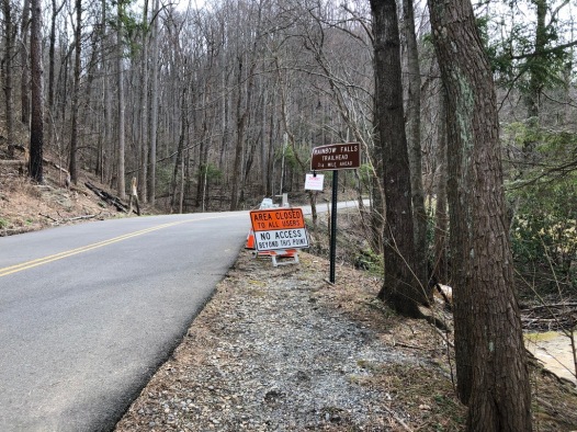
Long story short, we saw a tree truck go by so we figured the road may have been opened. So we drove back up. And the road was re-opened.
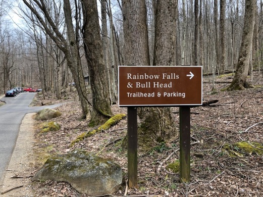
The Trailheads are co-located. But hardly anyone goes for the Bull Head Trail.
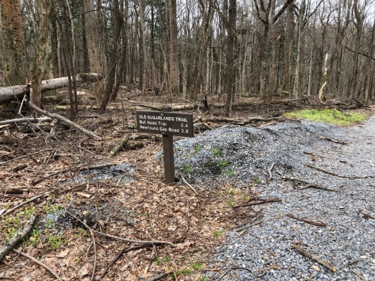
The Bull Head Trailhead is just a few 100′ away.

Even though I had researched this hike, I didn’t really pay attention to the elevation. It started out pretty flat.

Bill was excited to see evidence of Spring so he had to take a picture. Daffodils were blooming before we headed up!

Bill dislikes bridges about the same as he dislikes heights! But he really enjoys hiking so he just does it!

Up we start to go. And up and up! The trail wasn’t bad, narrow in a lot of places but at least not the rocks like Charlies Bunion.
Lovely terrain! It will be too far for us to hike to the Rainbow Falls today. So Bill said these were good enough for him! I’m just so blessed to be able to walk and hike, I’m happy with anything!
I’m happy with anything, even a boulder hanging over my head?!?!?! 😳
Up up we go!

Bill pointing towards Gatlinburg.
Oh my, we are getting some nice views of Gatlinburg. And we are seeing the remnants of the fire of 2016:
This is a fire for the history books,” Gatlinburg Mayor Mike Werner said. “It’s unlike anything we’ve ever seen.” (Another story is here if you missed it.)
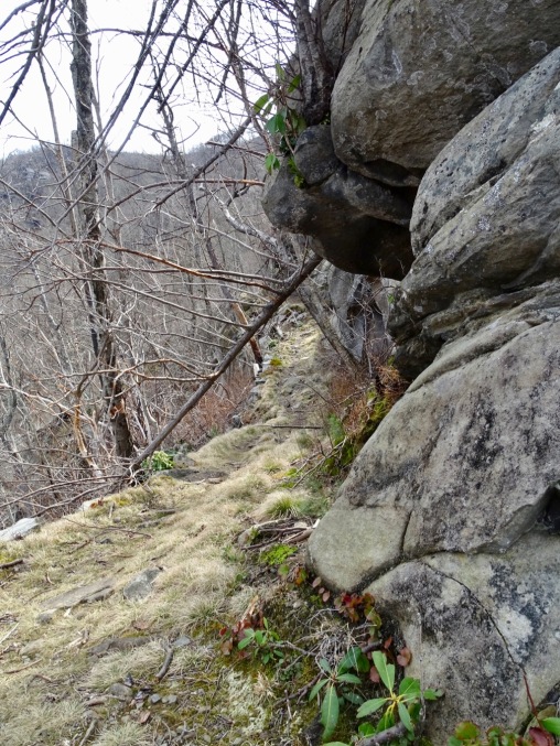
The trail was challenging at certain points – and narrow. We kept forging on around and around we went!
A better picture of the narrow trail and the challenging terrain. It made for an interesting hike!
And a number of trees down that blocked the trail. We were very careful as we climbed over them….we are up a ways. Sadly, I wasn’t able to see our elevation as we hiked back down.
We finally decided to head down as we felt the winds whipping up. All the red dots are pictures I took as we climbed up. The Rainbow Falls Trail was still a bit of a ways away….
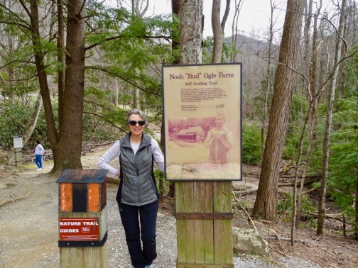
After the hike, we stopped nearby to visit the remnants of an old farm.
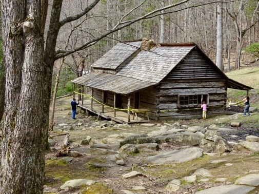
The main farmhouse.
The Bud Ogle Cabin, built in the late 19th century by it’s namesake, Noah “Bud” Ogle, was a farm and cabin located in the Great Smoky Mountains National Park. The homestead consists of a cabin, barn, and tubmill, all of which were built by Bud Ogle, and were added to the National Register of Historic Places in 1977.
The Bud Ogle Cabin itself is actually two cabins that share a single chimney, often referred to as a “saddlebag,” cabin. The two cabins were built roughly five years apart, the second cabin added to accommodate Noah’s growing family. Both of the cabins measure 18 feet by 20 feet and the construction is the same, both one story with a loft and made of hewn logs with half-dovetail notches. The land also include an apple orchard and Noah Ogle also grew corn.
Well, that wasn’t exactly an easy hike – but it gave us the solitude we enjoy. But we were sure satisfied with the hike and our progress. We are staying in a hotel downtown Gatlinburg. It’s a dated hotel but somehow we got the deluxe suite with a much needed jacuzzi hot tub. Our muscles needed it after these hikes!
Our last hiking day, we decided we wanted another hike like Bull Head – maybe not as high of elevation climb. After research on all trails, I found Ace Gap Trail (click for details.) It sounded perfect, but the downside was that it was nearly an hours drove on the other side of the SMNP. But to us it seemed worth it. But we really should have looked at Google Earth (suggested by fellow blogger and hiker, Pam Wright) to check out the drive. We would have discovered it was a long, narrow, winding road up up up a steep mountain. We were on a similar road one time, but in our truck. Now we are in a smaller and more nimble car. But Bill decided he couldn’t go to the top. We saw so many trees down and big tree trucks up and down the roads – what if we met one on the road? No room…..Here is a three second video to give you a taste of the road there!
So back to square one. We lost nearly two hours going to Ace Gap. So I quickly do a search and the best we come up with is Abrams Fall:
Abrams Fall is a popular waterfall with a 25 foot drop over a rocky cliff beside it. The trail is well maintained. It does have a few spots with roots and rocks. The trail gets a lot of use. Expect other hikers. At certain times of the year, it will be extremely crowded. (From All Trails website.)
We thought we hiked on this trail in 2012, but I couldn’t find any pictures of it. Bill says we did it and he had memories as we went along on the hike, remembering that indeed, we did hike here. It was another rewarding day, pictures to follow:
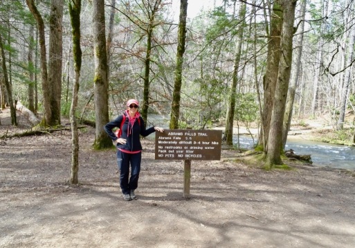
The trailhead. The parking lot was pretty full. But it looks like we’re the only ones here, right? Note, it says “moderately difficult” and takes “three to four hours.”

There’s the crowds! It was a pretty steady stream of visitors. So I figured it must be a pretty easy hike. We decided we didn’t need our poles – and for the most part, we didn’t.

There were definitely some areas of elevation. This was a rather nice trail area.

And then there were some more challenging areas!

After I took the above picture, Bill turned around and snapped this for another view of the rock steps! Note a few minutes of solitude!

There were so many families on the trail and several bridges like this. I am not sure how many with little ones did the entire 5 miles. We saw a few older children complaining.
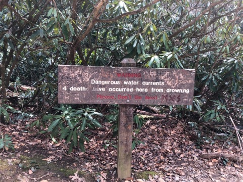
We’re just about to the Falls and then there is this sign. “Warning. Dangerous water currents. 4 deaths have occurred here from drowning. Please don’t be next.”

And here is the reward! Due to several downed trees so we didn’t go any closer. Several younger people did climb up and over to get closer.

And here is Abrams Falls! I don’t know if you can see it in this picture. But there were some teens at the top of the falls, sitting on the edge….

This gives you a good picture of the elevation and descending throughout the near 5 1/2 miles. It was a great workout. The only one time I regretted not having our poles was on the last long climb up – I use them to help pull me up on such steep slopes!
This ends part two of our two week trip. We absolutely enjoyed our times on the trails and it made us really miss our motorhome lifestyle. BUT the good news is we are learning to adapt. You may notice we don’t talk about restaurants or what else we did while here. We’ve never been big on eating out – which was why it was great having our kitchen and well-stocked refrigerator with us. We’ve become clever and are figuring it out. More on that later. Upcoming will be our time in Indiana after family time in Illinois.

“They will be like a tree planted by the water that sends out its roots by the stream. It does not fear when heat comes; its leaves are always green. It has no worries in a year of drought and never fails to bear fruit.” Jeremiah 17:8




Oh wow, this is amazing, such an adventure! I think a well-deserved break was definitely in order, a little recharge, space & solitude, and a boost of your spirits, too. And it’s great you got to go when you’d finally after you couldn’t last fall. I love the water and the little waterfall, it looks so peaceful and refreshing there. You have some great photos and lovely memories to cherish!
Caz xx
LikeLiked by 1 person
Thank you for your interest and comments. It was amazing and our batteries are recharged! I’m glad you enjoyed the trails with us! 😉
LikeLiked by 1 person
Wow, what a trip! Next year that will be us, traveling the States once again and enjoying life to the fullest hopefully. (When we stopped in Gatlinburg again, we were saddened to see how they changed this sweet little German town into another tourist trap. ) Please remember us in prayer this Sunday, for safety, as we begin our new adventure traveling down to north Florida, 🙂 We’ll meet soon, I’m sure of it! ❤
LikeLiked by 1 person
It was great, but I have another week to write about! It’s so hard to blog again-I’m rusty!
I’ve been thinking of you and wondering when your journey south begins. Praying especially for good weather. We hit a lot of construction while heading into the hot sun! We were so happy for sunshine but it was cooking us!
Good to have fun travels to look forward to! 🙏
LikeLiked by 1 person
I’m sorry to leave our friends here. We have such wonderful, close friends!!! We have 6 friends helping us pack the truck and a big goodbye party the night before, I’m sure however, they will all visit us searching for sunnier weather! 🙂
LikeLiked by 1 person
It’s always sad to leave such good and supportive friends! Praying God blesses you with many new friends to help in your transition!
LikeLiked by 1 person
How fun, I hope you had a safe trip!
LikeLike
We did! Thank you. It was great and we look forward to more such trips!
LikeLiked by 1 person
Hello.
Awesome hiking post. Thank you.
have a good day!
LikeLike
Thank you for reading and commenting!
LikeLiked by 1 person