
It’s been over two months since we’ve had a great mountain hike. So we were chomping at the bit to get back to one of our favorite places to hike, the Shenandoah National Park. Since we were rusty, we didn’t plan to maximize our time for the hike. But as it turned out, our Lord knew best and HE ordered our steps on this date (September 2, 2015).
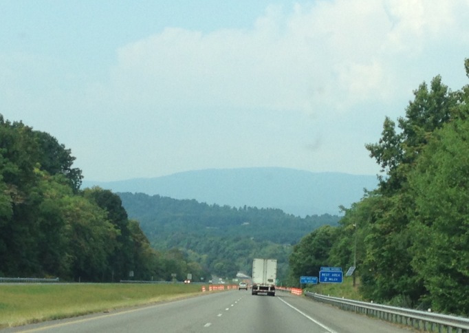
We’re on Interstate 64, headed from Gordonsville to the Shenandoah National Park
We love hiking in this park. We’ve hiked here many times and it may be one of our favorite go to places for excellent hiking. In fact, we’ve driven the entire distance of the scenic Skyline Drive in our truck, pulling our 5th wheel. Read about the start of that trip here. While we loved the experience, relished the beauty and fabulous panoramic views, we learned it’s not really ideal for RVs for a few reasons. Although we met others in their campers, actually dry camping there and we did think for a few minutes how cool that would be. But we’re addicted to our full hook ups (water, sewer and electricity).
Main reason we wouldn’t do it again or recommend it for motor homes, are the very winding roads and the impatience of other drivers. The speed limit is normally 35 mph (for 100 mile trip, that’s a bit slow) but people push 45 easily. The Blue Ridge Parkway further south, into North Carolina, is 45 mph for the most part. And it is every bit as beautiful.
A little description about of these scenic drives, as they get mixed up (and we were mixed up) until we drove the entire length of the Skyline (Virginia) and parts of the Blue Ridge Parkway (North Carolina for simplicity). These are certainly some of the most beautiful roads in America! Starting at Front Royal Virginia, just 75 miles from Washington, DC, you drive south west for the next one hundred and five (105) miles down to I-64. This is called the Skyline Drive and is on the “top of the world” in the Shenandoah National Park on top of what’s called the Appalachian Mountains.
The building of the Skyline Drive was started in the middle of the summer in July 1931 and was one of the first scenic highways ever built in the United States. After you drive the 105 miles of The Skyline Drive you will then be on The Blue Ridge Parkway (BRP) which has a forty five (45) mile-an-hour speed limit and continues south west for the next Four Hundred and seventy (470) miles to Cherokee North Carolina. We’ve only driven and hiked on portions of this fabulous drive. Here we are on a favorite hike at the top of the BRP.

The highest point on the parkway (south of Waynesville, near Mount Pisgah in North Carolina) is 6053 feet or above sea level on Richland Balsam Mountain at Milepost 431
And since I have it handy, one of our clearest days to show the type of panoramic views from a top of the Appalachian Mountains. Sadly, the weather was a bit gloomy to get a great picture on this day.
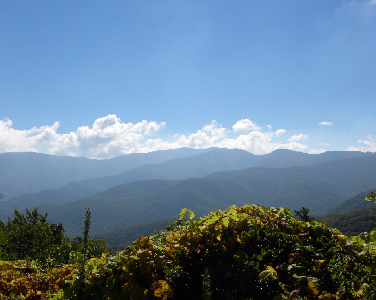
Our favorite view!
For this trip, we really hoped for at least a six mile hike to a beautiful water fall. There are 75 waterfalls off of Skyline Drive, and all are accessed via outstanding hikes. As we were on our way to Mile Post 84, we saw a bolt of lightening. Then we looked at our GPS which shows radar and weather. Thunderstorms predicted by 4 pm. It was only 1:00 so we decided we had time for a good hike, but decided we better not go for a long hike. I quickly looked at the map we were given when we entered the park. There is a fee to enter the park, but it is FREE for us now that Bill has an “America the Beautiful” pass. Bill remembered seeing there was a waterfall at Jones Falls Run, Mile Post 81. So we pulled over there as soon as we saw it. At least we would hike to a beautiful, but smaller waterfall at 32′. We had hoped anyway.
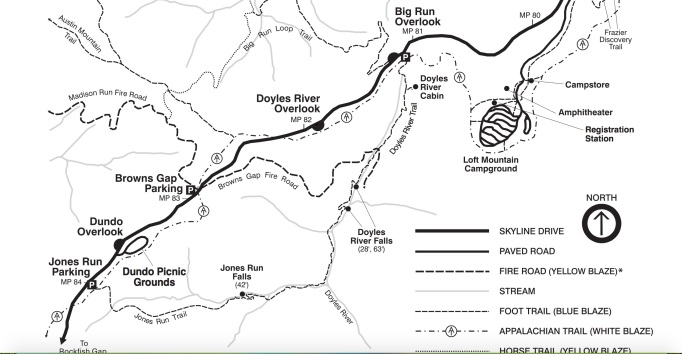
We were aiming for Mile Post 81, but stopped at MP 84
We stopped and examined the trailhead map. One thing we love about this park is how well it’s marked and the quality maps provided when you enter the park. It looked like we would get in at least 4 miles and it was a pretty steep descent, about 1,000 feet, meaning a rough ascent but that is what we like – a challenge. We prefer to start low and go high, but not today! Either way it is a challenge.
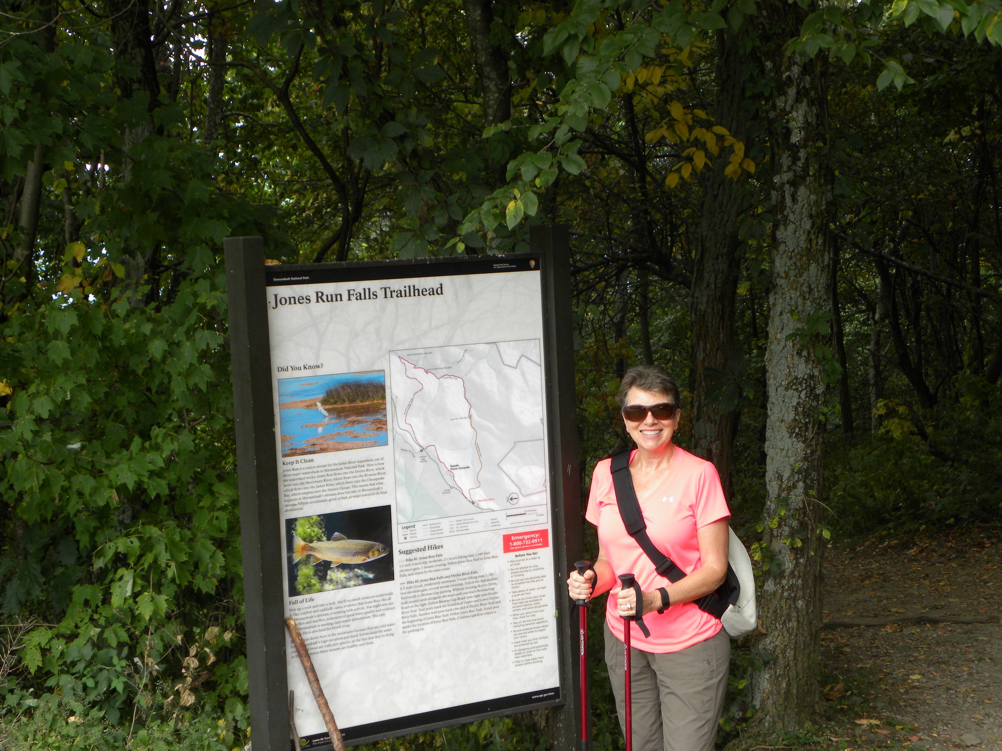
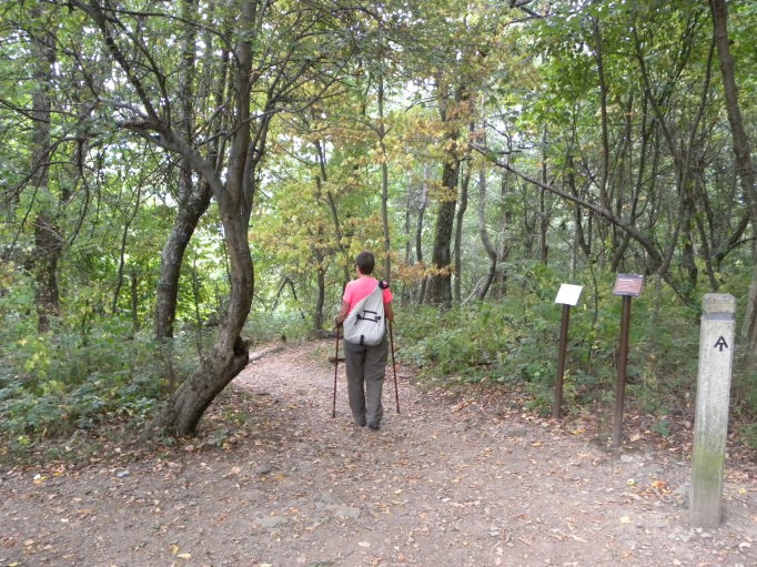
Trailhead for Jones Run Falls
When we arrived at the parking lot, there was a Minnie Winnie Class C motorhome and one car. Hiking during the week means you will see fewer people, which we always love – solitude. So down we began our ascent. Starting out, it was a nice path, but it began to get rocky and lots of roots. That always makes it more challenging. A family of five approached us, a mom, dad and three girls, ages about 8 to 14. They said they couldn’t make it to the falls as they had to get the girls home. They looked pretty beat, so we knew the return hike would be a challenge.
Starting off easy
It wasn’t long before we saw the owners of the Minnie Winnie, a husband, wife and their dog. They also said they didn’t make it to the falls. We thought this was strange as it was only two miles there. So we kept on, enjoying the solitude. We were approaching two miles when we ran into two college students from Prague, Czechoslovakia. There we on their last holiday before their senior year. They first visited New York City and wanted to hike on this trail! We asked them if they saw the falls. They said they had, but they did the entire hike from MP 84 and saw the Doyles River Falls. By now, we realized the Jones Falls must be dried up! We enjoyed talking to them but they said they needed to finish their trail as they were on a much longer hike and the weather was beginning to turn.

Dried up!
We use “Map my Hike” GPS tracker so it soon advised us we had completed two miles. The falls were supposed to be at 1.7 miles, so we knew it had dried up. We really felt good and decided we would go on at least another 1/2 mile for a full five mile hike. But within a minute, we heard a loud crack of lightening! We’ve been caught in a storm in the past. We were not prepared for this, we we immediately turned and began a fast pace back, up up up the mountain. The lightening kept us motivated. But we hit a few very rocky areas and could only go but so fast.

Bill going strong! But i the very rocky area.
Ah, but the ascent caught up to me and had to take a break, just 1/2 mile from the top. And of course, I am praying for the Lord to protect us. We could handle getting wet, but not stuck by lightening!

Just had to take a quick break! We were flying UP hill!
So in the end, we were a-ok and made it into the car safely. But it wasn’t 10 minutes when the heavens opened up and a serious storm started!
For our complete photo album, click here to Flickr.
“O give thanks to the LORD, for he is good: for his mercy endures for ever.” Psalms 107:1

[…] https://thetumblelees.me/2015/09/04/jones-run-falls-trail-shenandoah-national-park/ […]
LikeLike
Hey Hiker!!
Your favorite view is my favorite too. ❤
It's an interesting story and beautiful pictures. I loved all of them.
Happy weekend. Love and light ❤
Anand
LikeLiked by 1 person
Feel free to use it! No copyright here! 😀
LikeLiked by 1 person
My goodness Debbie. So generous! ❤ ❤ ❤
I am going to use it but with proper attribution to your name and blog. Thanks a lot dear 🙂 🙂 🙂
LikeLiked by 1 person
I agree – those drives are two of the most beautiful drives in America! Sorry you missed the waterfalls but it looks like a loved hike anyway. Glad you made it back before the storm hit!
LikeLiked by 1 person
Thanks for commenting! We do love the extra thrill of escaping a storm! I don’t think I wrote about the time we were caught in a storm in the Rockies. Since then, we really pay attention to the weather! Ah but a bit rusty!
LikeLike
[…] Follow the Tumble Lees! […]
LikeLiked by 1 person
I’m a little behind and I may have declined this, but I now have time and lots of wifi to accept. I’m following a number of other bloggers I’d like to see nominated!
LikeLike
Wow wonderful pictures! your favorite view is amazing!
LikeLiked by 1 person
Thank you! We’ve featured it on our open Facebook page, too.
LikeLiked by 1 person
Beautiful photos. You seem like you are having a wonderful experience in your travels.
LikeLiked by 1 person
Yes! I needed to write about the day my coffee maker broke….I thought of all my fellow blogosphere coffee drinking friends!
LikeLike
Beautiful photos. You seem to really enjoy your experiences in travel. Kudos!
LikeLiked by 1 person
Gorgeous!
LikeLiked by 1 person
Beautiful!! I lived in Virginia for 18 years and I have never been to Shenandoah Valley. It’s definitely a must see now.
LikeLike
We understand. We discovered it only a year before we moved and 9 years into our time here! When we moved to Florida, we vowed we would not miss any natural wonders. We can now say we have visited NEARLY every corner, nook and cranny of FL! And now, we seem to be doing the same since we began our full time travels, but in the SE USA!
Any chance you can make it back to VA? You have to drive on Skyline Drive!
LikeLiked by 1 person
That’s awesome!!! We live in Virginia. So we have to go. Safe travels!!
LikeLiked by 1 person
Oh, now I understand! It almost sounded like you used to live in Virginia. Check out the Skyline Drive website for the entrance points. It costs $10 for 7 days use, I believe. Once you hit 62, you can buy a lifetime pass for only $10 and then come and go as you please! It’s called “America the Beautiful” pass. Or if you are younger and want to start seeing more, it’s $80 for a year pass. Click here: http://www.nps.gov/findapark/passes.htm
LikeLike